
Our Technology
D'GIS Group develops and maintains a proprietary platform for web GIS development, GIS web mapping, and mobile GIS applications engineered for the demands of upstream energy operations. Our infrastructure is built from the start to handle data complexity, coordinate systems, offline workflows, and connectivity realities that define oilfield work.
Built from the ground up
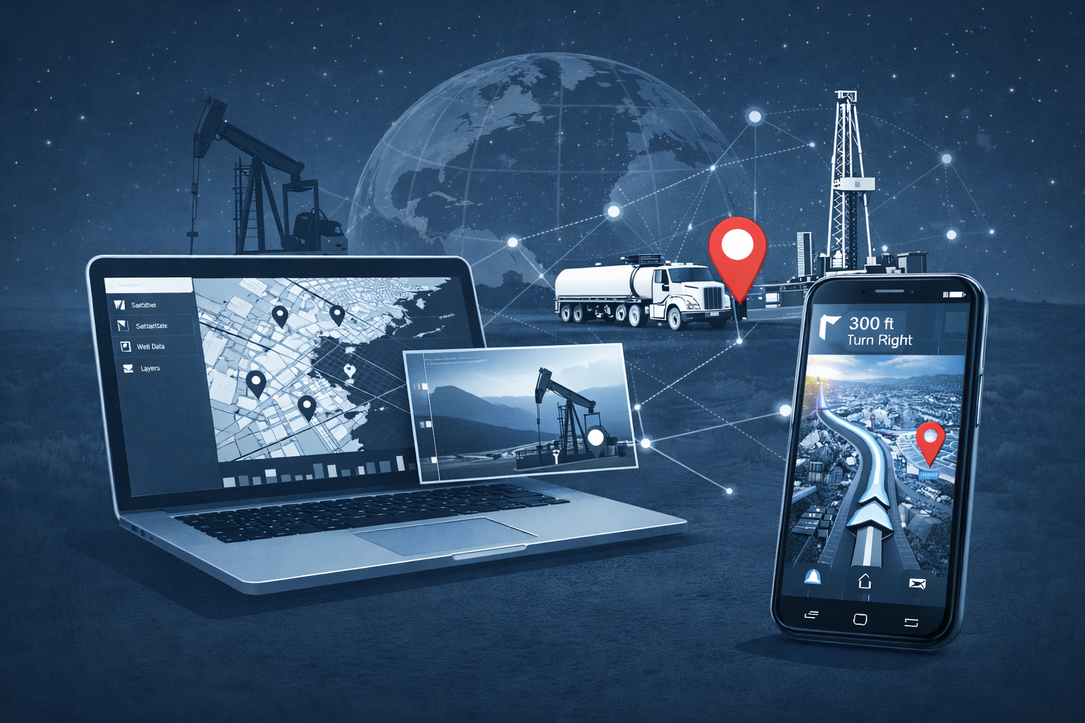
D'GIS Group develops a proprietary geospatial intelligence platform purpose-built for upstream energy. One connected architecture powers mapping, rig intelligence, and field navigation across Canada and the United States.
Unified data backbone
At the core of everything we build is a continuously updated dataset covering well licenses, spud activity, rig locations, and drilling records across Canada and the US. That data is ingested, validated, and structured in near real time — so whether a user is checking rig status on a mobile app or running an analysis on GeoActivity Maps, they're working from the same authoritative source.
Built for how the industry works
Our systems natively work directly with the identifiers used in Western Canada and the US - LSD/DLS, NTS, PLSS, UWI, and API. We support multi-jurisdiction data queries, regions of interest maps, advanced filtering by operator, well name, and drilling contractor, among other tools for further analysis.
An ecosystem, not a product
Our technology powers a connected suite of applications: web platforms for mapping and activity intelligence, real-time data feeds, and mobile apps for rig navigation, well finding, and oilfield route planning. Each product is independent, but all share the same data infrastructure, the same coordinate intelligence, and the same commitment to reliability in the field.
Field-ready ecosystem
Every product in our ecosystem is engineered to work for remote enviroments and for the office. Navigation, location sharing, offline access, real-time notifications and email alerts are not features we added — they are the foundation where our mobile platforms were built on.
Built for energy infrastructure
Our infrastructure includes well datasets, real-time rig activity, spatial data management, and lease road routing systems purpose-built for oilfield operations.
Well datasets
Comprehensive well location and attribute data across major producing basins.
Real-time rig activity
Live and historical rig activity data to support field planning and logistics.
Lease road and rural routing
Navigation for oil and gas wellsites, remote access, and oilfield conditions.
Oilfield navigation and intelligence
GeoActivity is a suite of oilfield-specific navigation and intelligence applications used by field professionals across North America for offline mapping, wellsite routing, and field-ready decision support.
Field Navigation
Wellsite-accurate turn-by-turn navigation designed for oilfield professionals.
Oilfield Mapping
High-detail maps with well locations, lease boundaries, and surface infrastructure.
Rig Intelligence
Real-time rig activity monitoring and alerts across North American operations.
Explore the full GeoActivity suite
View all mobile apps, web applications, and direct launch links in one dedicated destination.